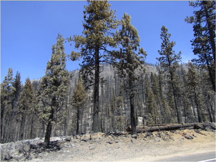
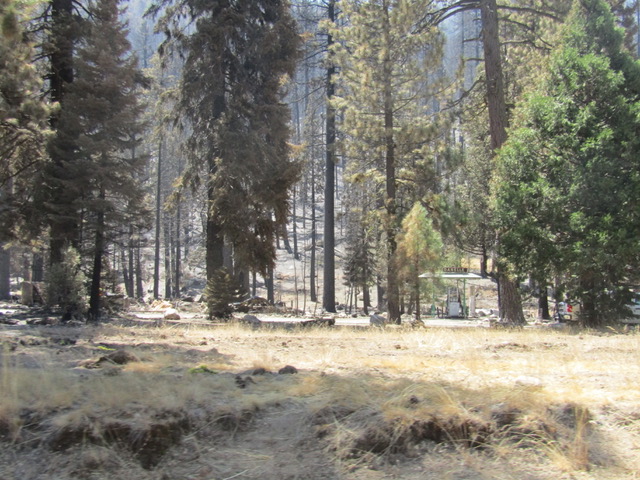
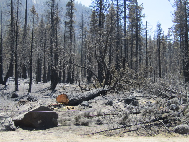
Most fire experts would never have predicted how much damage the Donnell Fire would cause when it burned across high elevation forest areas with lots of rocky terrain and patchy fuels. Sadly, winds caused the blow-up of the fire, sending it sweeping through areas with scattered cabins. It destroyed the historic Dardenelles Resort (see photo below with only the gas pumps standing). Then it rushed up steep mountainsides to consume thousands of acres of pristine, roadless forest areas.

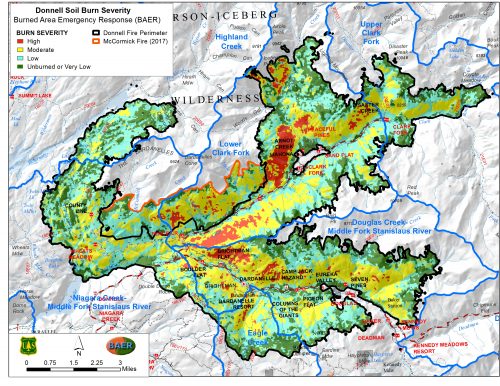
On August 2nd, the fire was discovered burning deep in a rugged canyon adjacent to Donnell Reservoir. Days later, winds drove the fire south along the main Stanislaus River Highway 108 corridor as well as east up the Clark Fork and the steep mountains above that fork of the river. More than 50 structures were destroyed before the fire expanded north and northeast into the Carson-Iceberg Wilderness, upslope into the Bald Peak roadless area, and south up the Eagle Creek watershed. By mid-September the fire had spread to over 36,000 acres, with most of the September growth in size being low intensity burning as the fire crept slowly at high elevations amidst rocky terrain, brush, and scattered forest patches.


For owners of cabins burned by the fire, the loss of sites that were rich in family memories added to the grief. For those who love wild, pristine older forest habitat, the high-severity runs that rushed upslope in the early days of the fire scorched vast areas with countless old growth trees that will never be replaced in our lifetime. Scenic values along the Highway 108 and Clark Fork corridors may soften the current stark visual impacts as nature gradually aids in recovery, but for wildlife that depends on late seral stage forest habitat and large, old growth trees, vast areas have been lost.
The cumulative impacts of the Donnell Fire combine with the far larger Rim Fire and other recent fires in the Stanislaus Forest to add up to extremely high numbers of total acres that have burned with far higher severity than what fire scientists describe as being the historic norm. Depending on winter conditions, the extensive areas with denuded slopes in the Donnell burn area may experience mudslides and erosion before vegetation re-sprouts next spring to aid in holding soil on steep mountain slopes.


